Validation and Verification
of Water Use
The Department of Water Affairs and Environment (DWA) embarked on a process of "Validation
and Verification" of water use in South Africa. This process is being done in a systematic process
throughout South Africa and purposes to license legal water use and eradicate illegal water use in
various sectors.
SiQ (as part of a consortium) was awarded the Validation and Verification project in various
Water Management Areas, including the Levuvhu-Letaba Water Management Area in Limpopo
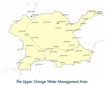
(2009), as well as the Upper- Orange Water Management Area in the province of the Free State
(2012).
The aim of the Validation and Verifications projects is to answer the next five questions:
- Who is using water?
- How much water is being used?
- Where does the water come from?
- What is it being used for?
- Is the use lawful?
These questions are being looked at for each farm in the designated area, and forms part of the
process that will lead to compulsory water licensing in terms of the new water act (Act 36 of
1998).
The following water uses are considered in this project:
- Water Storage (Dams on farms)
- Water Abstraction – Non-irrigation (e.g. Mining, Industry, Bulk Water Supply)
- Water Abstraction for Irrigation
SIQ’s role in this project was to do all the field surveys and to get all necessary information from
the various farmers. Not an easy task if you consider the sensitivity of the questions asked, as
water is at the heart of a farmer’s livelihood.
The team of surveyors that was used for this project was farmers themselves and understood the
way of thinking of the people who they had to interview. This greatly assisted in ensuring that the
information captured was accurate and relevant.
The process followed for the survey included:
- Compilation of an information pack for each farm portion. That meant that one farmer could
have more than one information pack due to the fact that he may own more than one farm
portion.
- Handing out of information packs to individual farmers. This was done during meetings arranged
with the farmers through Agri Unions, Water Boards and Schemes etc. Farmers were
also individually visited, especially the bigger farmers.
- The farmers were then given some time to review the information packs and obtain any additional
information required.
- One-on-one meetings were then arranged with the farmers to hand back the information
pack, and to discuss this with the surveyor team members. This was done at a centralized
location, as well as on individual farms.
To make the visits as fast and cost effective as possible, appointments were made with the farmers
where possible. Although it saved time – because you know you will get the farmer on the
farm – it also solved another problem associated with farm visits in that most farmers don’t like
unannounced people driving around on their property.
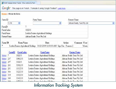
In addition to various software systems customized for this project, a specialized, web based
"Information Tracking System" was developed to keep track of the vast amount of data. An internet
web page made it easy for the farmers that couldn’t attend a meeting to complete the whole
process on the web.
For the Upper Orange are the amount of farms where information was provided to owners was
4312 with a return rate of 74% completed information packs. The client was extremely satisfied
with the project, and uses it as a showcase of how this type of project should be done.
|